OVERVIEW OF WPDx’S TOOLS
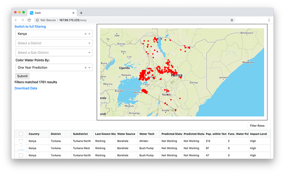
The data available through the Water Point Data Exchange provides a powerful foundation for advanced analytics. By harmonizing the data in WPDx and employing geospatial information systems and machine learning, WPDx has created four powerful tools to help governments and their partners make data-based decisions on a regular basis. These tools were designed to be very simple and user-friendly.
You can access the tools by going to www.waterpointdata.org/insights.
* Please note that the tools are in beta test stage and all insights should be validated by local stakeholders. Feedback is always welcome.
THE TOOLS
– PREDICT CURRENT WATER POINT STATUS TOOL
This tool harnesses the power of machine learning to make predictions about the status of water points based on the past performance of similar water points in the country.
– PRIORITIZE LOCATIONS FOR REHABILITATION TOOL
This tool evaluates all water points that are not producing water in a given district and evaluates how many people that currently lack access could be reached if the water point was repaired.
– PRIORITIZE LOCATIONS FOR CONSTRUCTION TOOL
This tool evaluates all possible locations that a water point could be constructed in a given district and evaluates how many people that are not near an existing water point (regardless of functionality) could gain access if a water point was constructed in that location.
– MEASURE WATER ACCESS BY DISTRICT TOOL
This tool provides an estimate on rural basic water access, providing the percent of the rural population in each district in a given country living near a water point that provides water.
