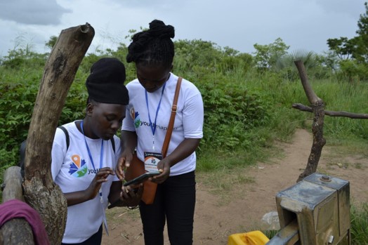

Photo credit: Stellamaris Nakacwa
With contributions from Stella Nacakwa, M.S. Candidate, West Virginia University & Courtney Clark, YouthMappers.
The Gulu University chapter of YouthMappers, in partnership with YouthMappers, West Virginia University, the Water Point Data Exchange (WPdx) and the U.S. Agency for International Development (USAID) have been collaborating on the Uganda Water Infrastructure Mapping Project (U-WIMP). For additional information on the project, please see here. Briefly, the project identified two complementary goals including:
- building the technical capacity of Ugandan YouthMappers in both mapping and spatial decision-support analysis, and
- demonstrating the possibilities for making evidence-based decisions through the collection of digitized water data and the application of cutting-edge data analytics to district and regional government officials and partners.
During the winter of 2021/2022, students receiving training on the following topics:
- Geospatial concepts and principles
- Analyzing satellite imagery to identify buildings, roads, and other features
- Editing OpenStreetMap (OSM) using the JOSM (Java OpenStreetMap) editor and the Humanitarian OpenStreetMap (HOT) Tasking Manager
- Conducting fieldwork to collect data using Kobo Collect on smartphones
- Understanding structures and processes related to Water, Sanitation, and Hygiene (WASH) in Uganda
- The importance of developing and implementing digital systems for WASH in Uganda, including an introduction to WPdx.
Data Collection with KoboCollect
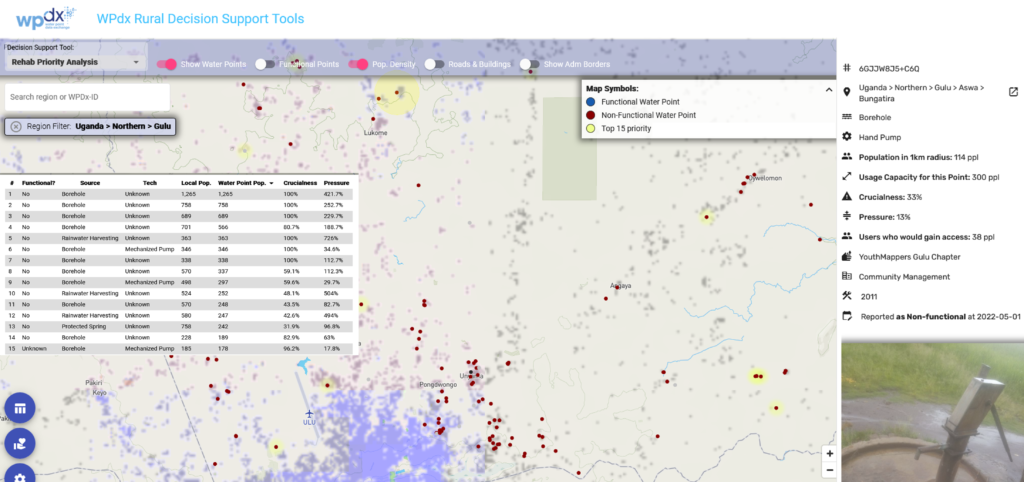
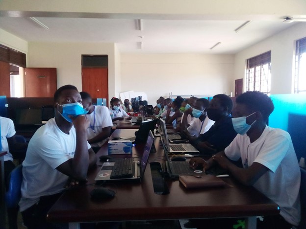
In late May, a team including 30 student members from the Gulu University Chapter of YouthMappers, two Gulu University professors, and members from YouthMappers headquarters completed a mapping exercise to collect data on the water points in two sub-counties in Gulu District, Uganda: Bungatira and Unyama. The team utilized a customized KoboCollect app downloaded onto smart phones to collect a suite of parameters based on the WPdx Data Standard. The parameters included:
- GPS location (#lat_deg, #lon_deg),
- Date of Visit (#report_date)
- Administrative division (#adm)
- Type of water point (#water_source, #water_tech)
- Functionality status (#status_id)
- Management type (#management)
- Subjective water quality (#subjective_quality)
- Installation date (#install_year)
- Photograph (#photo)
Automating Uploads to WPdx
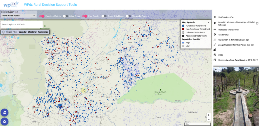
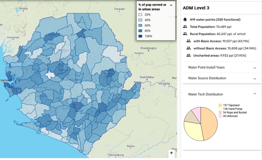
Over the course of two weeks, the field team collected over 600 water data points from 26 villages in Gulu District. These data are now freely available through WPdx’s database and decision support tools. Through a connection between the KoboCollect API and the WPdx ingestion engine, data was
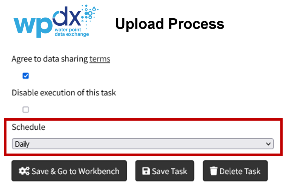
automatically uploaded each day, allowing a near-real time view of the available data on the WPdx Decision Support Tools app. In addition to water point data, more than 15,000 buildings and 1,400 square kilometers of roads for these villages in Gulu were digitized using OSM, and this geographic data is freely accessible to the local government, NGOs, and the public to use for not only water infrastructure projects but any project requiring an accurate, digital base map.
This project demonstrated a digital waterpoint data collection process that made the data available freely and openly online, in near real-time. The project improves upon the current paper-based data collection process by introducing simple digital tools that leverage mobile technologies and cloud platforms to collect and store field data. The project was not an attempt to replicate a full water point census, but rather to innovate and test a process for how a district or region, or NGO, in Uganda can conduct a simple, low-cost, targeted collection of water point data which can then be analyzed to support evidence-based decisions.
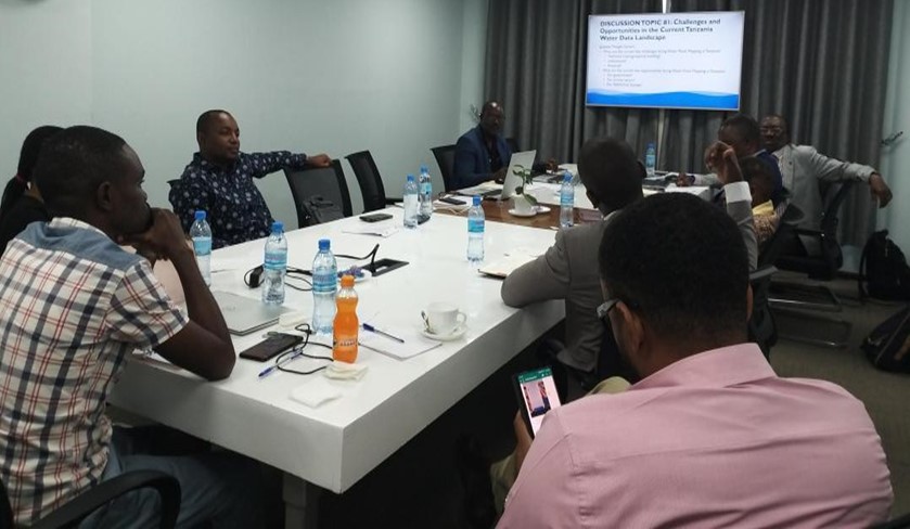
Stakeholder Workshops
Throughout the project, the U-WIMP team engaged district and regional officials from the Ugandan Ministry of Water and Environment and NGOs with operations in Gulu, Uganda that generate and/or use data on water point functionality and location. Following the field data collection effort, in June 2022, the team hosted a day-long knowledge-transfer workshop for 25 participants including Gulu district and sub-district government officials and NGO staff working in the water sector to create awareness of the project, train participants on the technology workflow and WPdx’s decision support tools, and seek their input and feedback. Following the workshop, the team hosted seven one-on-one interviews with government officials to gather diverse perspectives on current successes and challenges regarding the gathering, sharing, and using water infrastructure data.
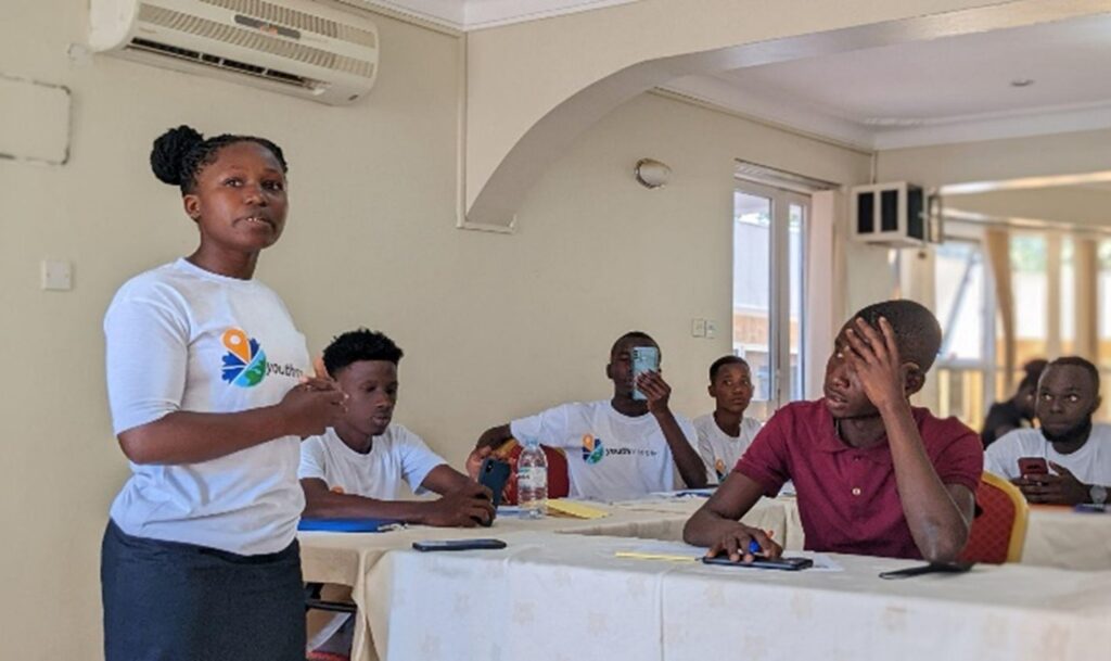
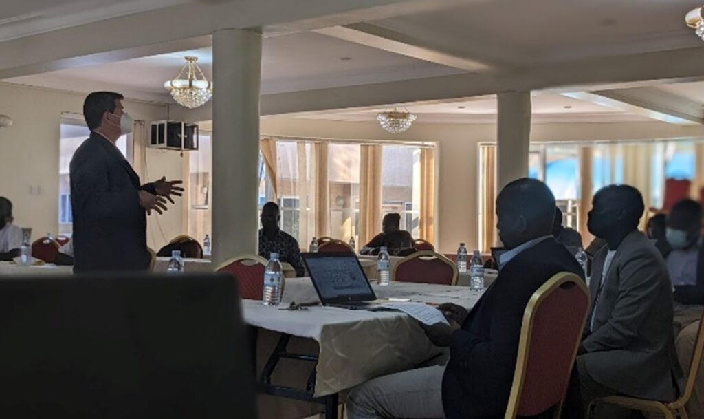
Photo credits: Stellamaris Nakacwa
A key finding from the workshop and interviews was that local and regional water officials experience significant challenges with the current paper-based method of water point data collection. Local and regional officials must often wait months after enumerators submit their paper data collection forms before these officials can access, analyze, and use the data. Through this project, this group now has access to up-to-date digital data and analytics for water points for the Bungatira and Unyama sub-counties in Gulu District.
The streamlined process for digital water point data collection that was piloted through this project is ready for implementation by government and NGO partners in Uganda. This project centralized the participation of YouthMappers students at Gulu University in learning and implementing the associated tools and processes. These students are project champions and experts in the technology and processes used, and they are now available to train government and NGO officials on using OSM and Kobo Collect to collect digital water point data and WPdx to share and analyze this data.
Next Steps
Conversations are ongoing with partners regarding opportunities to continue and expand this model in support of efforts to digitize and use water point data in Gulu and other districts in Uganda.