Announcing the WPdx Monitoring, Evaluation, Adapting and Learning (MEAL) Guide

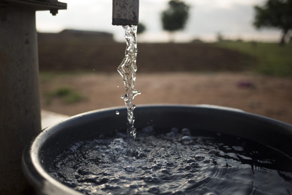
The WPdx Data Standard was created in 2015 by an expert working group and defines a set of basic parameters that should be collected when gathering water point data. The Standard was designed to accept data from a variety of formats to compile a global dataset of water point records. That said, one of the challenges in compiling data from a variety of sources is transforming the different datasets to use a uniform set of terms and categories to ensure the final dataset is consistent and analysis-ready. The Standard allows for open text responses, which means that substantial data cleaning is necessary to create a dataset that is consistently formatted for analysis. WPdx automates this cleaning process using a combination of pre-defined categories, natural language processing (NLP) and detailed reviews, but recognizes that there is the potential for error and misinterpretation. 

The purpose of a data standard is to ensure not only that the right parameters are collected, but that data is collected in a way which is consistent and comparable with data from other organizations and collection efforts. WPdx created a new Monitoring, Evaluation, Adapting, and Learning (MEAL) Guide as an annex to the WPdx User Guide to reflect recent updates to the WPdx Data Standard, which defines both the standard parameters and provides a suite of recommended responses. The WPdx platform will continue to clean and categorize data as needed, but recommends that this document and its associated parameters and responses be used by entities as the minimum required during data collection efforts.

A simple example which demonstrates the needs for this process is a potential set of entries provided under the #water_tech parameter, which describes the system being used to transport water from the source to the point of collection. A common entry for this parameter is a hand pump, and one common manufacturer of hand pumps is Afridev. Depending on the organization collecting data, datasets uploaded to WPdx to describe an Afridev hand pump might include Afridev Handpump, Afridev hand pump, HP – AfriDev, Afri Dev pump, Afri Ev, etc.

In order to make this information analysis-ready, the terms above must be translated into a consistent format. The table below provides a sample of common entries received and how they appear in the WPdx dataset. 

Table 1. Examples of how #water_tech entries are transformed to #water_tech_clean

#water_tech

Common entries received for Afridev Hand Pump

#water_tech_clean

Amended entry on WPdx

Afridev


Hand pump – Afridev


AfriDev
Afridev Handpump
AfriDev Handpump
Hand Pump Afridev
Aferdive pump
Afridev, Hand pump
Pump AFRIDEV
Hand pump Afridev
Handpump-Afridev

Undetectable errors and discrepancies during the data cleaning process may impact the results of predictive analyses like the WPdx Decision Support Tools. If there is a collective interest in having data compiled for analysis, it is imperative to adopt standard parameters and responses across organizations. The WPdx MEAL Guide is a tool for partner organizations to reference during the design of data collection surveys or after data collection but prior to upload to the WPdx platform, so that those most familiar with the data can ensure it is interpreted accurately during the data cleaning process. 

Please review the WPdx User Guide and the MEAL Guide annex to understand the recommended standardized responses for inclusion when developing a survey for both required and optional parameters from the WPdx Data Standard.

Questions and Feedback

Please reach out to info@waterpointdata.org for more information.

Interested in sharing data with WPdx? Please see here for more details.

Tutorial: Applications of the WPdx Decision Support Tools

We are excited to share two new resources exploring applications of the WPdx Decision Support Tools app:

  1. A detailed written tutorial with pictures describing how to use each tool by examining a sample case in Farta, Ethiopia
  2. A slide deck tutorial explaining potential use cases for each decision support tool using an example in Kabarole, Uganda

Both resources also reference video tutorials published on the new WPdx YouTube Channel.

The WPdx Decision Support Tools interactive web app allows users to view and explore available water point data and results from the WPdx+ dataset and suite of decision-support tools, including:

  • Administrative Region Analysis
  • Rehabilitation Priority Analysis
  • Service Gap Identification Analysis
  • Data Quality Score
  • Status Prediction Analysis (BETA)

The Status Prediction Analysis is the newest tool in the WPdx Decision Support Tools suite. The tool is currently in the beta testing phase. However, it has functional predictions and our team is actively working with our partners at DataRobot to continutally improve the accuracy and reliability of these predictions.

Both tutorials provide an introduction to each of the tools in the WPdx Decision Support Tools suite through specific use case examples. Users will learn how to:

  1. Navigate each of the decision support tools.
  2. Filter to an organization or area of interest.
  3. Explore multiple use cases for each tool.
  4. Interpret the results for each tool.
  5. Export the results for external use.

Review the WPdx User Guide for information about how to use the entire WPdx platform.

Questions and Feedback

Please reach out to info@waterpointdata.org for more information.

Interested in sharing data with WPdx? Please see here for more details.

Additional Insights from Implementing WPdx in Ethiopia

Photo caption: WPdx training delivered by MWA to government stakeholder and Sustainable WASH Program implementation partners in March 2023. Photo credit: Selamawit Tiruneh 

Over the course of three years, starting in 2020, the Water Point Data Exchange (WPdx) partnered with the Millennium Water Alliance (MWA) in collaboration with the Sustainable WASH Program in Ethiopia to support improved decision making for the rural water sector in the Amhara Region. Highlights from this journey have been shared by the MWA Ethiopia team in three blog posts available on the WPdx News site:

In addition to these posts, MWA prepared two case study documents described briefly below and available at the provided links:

Using WPdx for Decision-Making in Water Point Implementation in Ethiopia

  • Describes how the Millennium Water Alliance (MWA) applied WPdx to conduct a service gap identification analysis in three woredas (districts) in the Amhara
    region, as part of the Sustainable WASH Program (SWP) funded by the Conrad
    N. Hilton Foundation.
  • Highlights the benefits and challenges of using WPdx and its decision support tools, such as measuring water access, prioritizing locations for rehabilitation
    and new construction, and predicting water point status.
  • Concludes that WPdx has the potential to transform the decision-making process in the water sector, by providing evidence-based insights, improving resource
    allocation, enhancing service delivery, and increasing accountability. The post includes recommendations about how to address issues such as data quality,
    reliability, privacy, usability, and collaboration to fully realize the potential of WPdx.

The Case for a Private Instance of WPdx in Ethiopia

  • Discusses the challenges and opportunities of water point data management in
    Ethiopia, where access to safe and sustainable water services is low, especially in rural areas.
  • Highlights the benefits of implementing a private instance of WPdx in Ethiopia, which would address the concerns about data privacy, reliability, and accountability. It would also allow for customization based on Ethiopia’s specific needs and parameters.
  • Concludes that a private instance of WPdx would empower the government and
    stakeholders to make evidence-based decisions, allocate resources effectively, and improve water service delivery in rural Ethiopia.

Acknowledgement: Funding for the work discussed in the post was generously provided by the Conrad N. Hilton Foundation.


Generating New Insights from Existing Data To Improve Access to Basic Water Services in Kabarole, Uganda

Figure 1. Kabarole district officials after the launch of the district WASH data porta. Photo credit: Mary Ayoreka Concepta, IRC Regional WASH Officer

Guest blog contributed by: Moses Asiimwe, IRC WASH Uganda and Bruno Basudde, Kabarole District Local Government

Please note: This blog will be cross-posted on the IRC Uganda and Kabarole District Local Government websites.

Like those in many other service sectors, the decision makers in the water, sanitation and hygiene (WASH) sector experience challenges in using data effectively to devise appropriate strategies to improve service delivery. One of the key hurdles is collecting new and/or locating existing high-quality data, which can be such a daunting task, especially in the face of the meagre resources often available for many organisations. If this data can be found, one then wonders where to look for simple, user-friendly, and cost-effective solutions for data analysis within and beyond organization level.

District Data Collection and Analysis

Considering the above, and with funding from the Conrad N. Hilton Foundation, in August 2022, IRC, in partnership with Kabarole District Local Government (DLG) carried out service level monitoring to establish WASH service level trends with focus on availability and functionality of WASH facilities, level of water service provision, asset age (repair/maintenance), and user satisfaction using the mWater platform. Later, and of paramount importance to IRC and Kabarole DLG, further data analysis using the Water Point Data Exchange (WPdx) added value by generating action-oriented insights to use the collected data to inform district planning and implementation of programme interventions by lower-level local governments (sub-counties). One especially useful analysis was a detailed comparison between the previous service level data (2019) and the most recent dataset (2022) focusing on water service. The datasets from 2019 and 2022 were analyzed both independently and as a harmonized dataset, to reflect the most up-to-date information. There were 45 verified water point matches between the two datasets. Of those 45, 11 changed status between 2019 and 2022, with 9 points being brought to a functional status and 2 becoming non-functional. 

Piloting a Private WPdx Pipeline

A full analysis was conducted using a pilot private version of WPdx which allowed IRC to select a customized dataset to be analyzed using the WPdx Decision Support Tools. Though recent data had been collected, the district had questions about how to effectively analyze and use the data to inform decisions. WPdx presented a unique opportunity to explore ways to best use the data as it is an open-source platform designed to address such challenges by unlocking the potential of water point data. Partnering with the WPdx team, the Kabarole service level data was uploaded and analyzed on a private version of the WPdx platform with minimal additional effort. The WPdx team worked with IRC to connect directly into the Kabarole DLG database to easily share the dataset with the WPdx platform. The resulting analysis enabled the district to tap into invaluable insights about water point sustainability which are in the process of being integrated into the District WASH Masterplan (2018 – 2030) and the District Improvement Plan (DIP). The findings from the WPdx tools are supporting the district to make evidence-based decisions to improve basic water service as the district continues to make fundamental strides towards realizing 2030 SDG 6.1 and 6.2 service targets.


Figure 2: Comparison of access by sub-district in Kabarole, Uganda using a customized version of the WPdx Administrative Region Analysis Tool.

In collaboration with the WPdx team, a number of relevant water service analyses were conducted, i.e., a comparison of water point types disaggregated by sub-county/survey year (2019 & 2022), functionality status (and associated functionality changes), population with and without access to basic water service, uncharted population (representing urban areas or such other areas without known service or where data may be missing), and the over-capacity population per water point (i.e., the number of people reliant on the water point for service above the recommended technical capacity). These insights created an opportunity for partners (IRC, Kabarole DLG and WPdx) to identify potential areas for new service locations and/or rehabilitation by identifying locations where populations currently lack access to a service, are reliant on a single water point with no alternatives nearby, and/or are reliant on a water point that is being over-utilized due to relatively high local populations.

Integrating Insights for Action

Efforts are ongoing to incorporate the WPdx results into the already established and recently launched district WASH data portal to provide the district water office a way to routinely monitor the level of water service provision and update new water source point information in a timely manner. Partners will use the insights from WPdx to inform the design of more strategic programs to reach the under-served populations within the district with affordable, quality, and sustainable basic water services, including exploring joint resource mobilization efforts to support the same cause.

Acknowledgement: Funding for the work discussed in the post was generously provided by the Conrad N. Hilton Foundation.


Validating the Impact: A Field Visit Assessment of WPdx Rural Decision Support Tools in Ethiopia

Figure 1. Dera Woreda Validation Team using WPdx Rural Decision Support tools to identify the top three priority areas for new water point construction work

Guest blog by: Selamawit Tiruneh and Mussie Tezazu with the Millennium Water Alliance

This blog is cross-posted on the Millennium Water Alliance website at this link.

The water management landscape in Ethiopia has faced numerous challenges, particularly in terms of collecting, organizing, and efficiently utilizing water point data. The Water Point Data Exchange (WPdx) is an open-source platform designed to address these challenges by unlocking the potential of water point data. It provides invaluable insights into water point sustainability, thereby supporting evidence-based decision-making to improve water services.

Despite efforts to systemize water point data in Ethiopia, including the National WASH Inventory II conducted in 2018, stakeholders have struggled with fragmented data collated via differing approaches, tools, and methods. The consequence? Valuable data are often used solely for reporting purposes rather than informing stakeholders and driving decision-making processes for prioritizing investments in new water points and rehabilitations.

The Millennium Water Alliance (MWA), through over fifteen years of work on water supply in Ethiopia, recognizes these challenges. Knowing the urgent need to strengthen the Ethiopian government’s capacity in water supply data management, analysis, and evidence-based decision-making, MWA partnered with Global Water Challenge’s Water Point Data Exchange (WPdx) to incorporate these factors into the development of the Sustainable WASH Program (SWP) with the support of the Conrad N. Hilton Fund. This program, aimed at systems strengthening, runs from 2019 to 2024.

Features and Functionalities of the WPdx Decision Support Tools

The Water Point Data Exchange (WPdx) Rural Decision Support Tools are robust suite of cutting edge analytics, offering unique capabilities that help decision-makers make use of data uploaded onto the WPdx platform. These tools, which integrate additional information from external population, demographic and environmental data sources, provide comprehensive insights for water point management.

MWA utilized the WPdx Rural Decision Support Tools web application to conduct a Service Gap (New Construction) Identification Analysis. This analysis aims to determine where new water points would provide the most access to people. MWA also completed a Rehabilitation Priority Analysis and a Status Prediction Analysis for the three targeted Woredas (Dera, Farta, and N. Mecha) of the Amhara region.

Selected Locations for Validation and Rationale

For validation purposes, the Service Gap Identification Analysis for one Woreda, Dera,  was chosen as it had the most recent and comprehensive data available (verified by Woreda Water Office). According to the Woreda Water Office, Dera has a total of 1,457 water points with a non-functional rate of 12.9%. Three locations within Dera were selected for validation, which were highlighted by the analysis as the top three high-priority areas for new water point construction.

Figure 2: Output of WPdx Rural Decision Support Service Gap Identification Analysis tool for Dera Woreda.  The team selected the top 3 sites from the list for validation.

Validation Process

The validation process was conducted by a multidisciplinary Woreda technical team. Members of this team included professionals from the fields of Water, Health Education, Finance, Management, Planning, and WASH Engineers from World Vision Ethiopia. The validation team compared the outputs from WPdx with the existing Woreda priorities. The process consisted of the following steps:

1. Identifying priority locations for new Water point construction in WPdx:

In collaboration with the Woreda Water Office experts, the location of the three top priority areas were identified using the WPdx Service Gap Identification Analysis tool. These points are ranked by the size of the population that lives within 1km of each proposed site. These populations are evaluated by WPdx as not having access to any existing functional or non-functional point based on available data. The villages of Kolacherkos, Abunehara Dingile, and Zemade were given the highest priority for new water point construction.

Kolacherkos village in Dewol kebele has a water service coverage of 36%.

Abunehara Dingile village in Kibebalata Kebele with water service coverage of 39.5%.

Zemade village in Mecho Kebele, has the lowest water service coverage of the three, at 18%.

These villages were identified based on their need for improved water access and the potential impact of new water points on the local communities.
Figure 3: Top 3 priority locations for new water point construction in Dera Woreda based on WPdx Rural Decision Support Tool

2. Water Coverage Evaluation: The team then reviewed the results of the Service Gap Identification Analysis. This analysis helped the team understand the extent of water access challenges in these communities and the potential population that could be served by placing new water points at the identified locations.

3. Water Point Data Verification: Upon zooming into the specific locations, the team asked the Woreda Water Office if there were any water points within a 1km radius that the community could access that were not captured in WPdx such as a private institution providing water. This was important in understanding the existing water sources and their sufficiency in meeting the community’s needs.

The verification also showed that these locations were located far from the woreda capital and inaccessible by vehicle and the team was therefore unable to visit the sites in person at the time. 

4. Review of existing Woreda New Construction Priorities: The team also asked the Woreda WASH technical team to identify their top three priority areas for new construction at that time to compare with the results from the WPdx analysis.

5. Consultation with the Woreda WASH Technical Committee: The team then organized a roundtable discussion event with the Woreda WASH Technical Committee. This committee is responsible for identifying priority areas for new water point construction each year, so their insights are crucial in understanding the status of water access in the identified locations.

During this discussion, the committee confirmed that the villages identified in the WPdx analysis are indeed priority areas for the construction of new water points. They also discussed the parameters they consider when prioritizing the construction of new water points, giving the validation team further insights into how decisions are made at the local level:

  1. Current Kebele water access levels
  2. Road access for mobilizing drilling rigs and other machinery
  3. Presence of existing institutions, such as healthcare facilities and schools, that can share water access with communities
  4. Comparison of budget available to the technology required at that location

Validation Results

The validation process affirmed the effectiveness of the WPdx tool in identifying priority areas for new water point construction. The identified villages – Kolacherkos, Abunehara Dingile, and Zemade – were among the Woreda’s priority areas. These findings corroborate the accuracy of the WPdx tool’s analyses and demonstrate its potential utility in informing and guiding water point construction decisions.

In summary, the validation process was comprehensive, incorporating both data analysis and consultation with local experts. The results have reinforced the value and applicability of the WPdx tools in supporting evidence-based decision-making to improve water services.

Stakeholder Discussions

Following the field visit, in-depth discussions were conducted with key stakeholders to further validate the findings and ensure a comprehensive understanding of the local context. These discussions provided valuable insights into the water supply challenges in the target areas and the potential benefits of the WPdx platform in addressing these issues.

Woreda WASH Technical Committee’s Insights: During the roundtable discussion, the Woreda WASH Technical Committee concurred with the identified priority areas and confirmed the need for improved water access in these villages. The committee members highlighted the fact that these villages are in remote areas far from the Woreda capital and with poor road access, making water supply efforts difficult. Despite the challenging topographical conditions and need for more advanced techniques like deep well drilling, the committee reaffirmed the importance of these areas for new water point construction.

Figure 4: Table level discussion with Dera Woreda WASH technical committee members

World Vision Ethiopia’s (WVE) Experience: Ato Mesfin Geremew, a WASH Engineer with World Vision Ethiopia, shared a previous experience where they attempted to establish a water point in Mecho Kebele (point 3). Due to the challenging nature of the terrain resulting in deep groundwater, traditional hand-dug wells were not a feasible solution. They resorted to roof rainwater harvesting to provide water access to the local health center, highlighting the complexity of water sourcing in these areas.

Woreda Water Office Priorities: The Woreda Water Office officials and experts outlined their current priority areas for new water point construction. Notably, they mentioned that points being constructed this year are in Kolacherkos village, identified by the WPdx tool as a high priority. This is a testament to the accuracy of the WPdx platform and its potential to assist in strategic planning.

Parameters for Prioritizing Construction Locations: The committee members also shared the key parameters they consider while identifying priority areas for new water points. These include existing Kebele level water access, road access, presence of community institutions such as healthcare facilities and schools which would be prioritized for access that would serve the community as well, and budget constraints relative to the required technology (deep wells vs. shallow wells). This discussion provided crucial insights into local decision-making processes, identifying an opportunity for tools like WPdx to be customized to consider a range of factors beyond simple water coverage. For example, although WPdx may identify a priority location, the water committees also consider technology requirements and their existing budgets.  Furthermore, the committee may prioritize providing institutional access, over a location that maximizes access to the most individuals, as identified by the WPdx tools.

Acceptance of the WPdx Platform: Overall, stakeholders commended the WPdx platform’s potential to support decision-making processes in prioritizing new water point construction locations. The ability of the tool to analyze a range of factors, such as population and location, and to prioritize based on these factors was acknowledged as a significant step towards more data-driven and evidence-based planning.

Recommendations and Next Steps

The validation field visit to the three prioritized villages offered a practical understanding of the accuracy and potential of the WPdx Rural Decision Support Tools in the context of rural water service planning. The findings were both encouraging and informative, underscoring the tool’s relevance and identifying possible areas for future customization and refinement.

Recommendations

Incorporation of Local Parameters: The effectiveness of the WPdx decision support tools was confirmed. However, to improve its precision further, MWA and the Woreda technical team recommend integrating local parameters into the tool. For instance, parameters such as road access, presence of local community institutions, and topographical (well depth and terrain) considerations should be considered.

Include Technology Recommendations: To enhance the Service Gap Identification Tool’s applicability, it should ideally also recommend the most suitable water supply technology for each priority area. The tool should consider data such as depth of existing wells in the vicinity, geology, and anticipated water demand when making this recommendation.

Stakeholder Engagement: Continual engagement with local stakeholders like the Woreda WASH Technical Committee and Water Office is necessary to understand their needs, improve the tool’s usability, and ensure its recommendations align with local conditions and priorities.

Next Steps

Regular Data Updates: To ensure the tool’s accuracy remains high and its recommendations are up-to-date, local government would need to establish a regular data update mechanism at the Woreda level. This will involve collaborating closely with local officials and stakeholders to ensure data is updated regularly and accurately.

Dissemination and Training: To increase the tool’s adoption and impact, MWA will further disseminate tools and conduct trainings with Woreda staff. This will involve explaining the tool’s functions, its benefits, and how to use it effectively.

Budget Mobilization: MWA will use the evidence gathered from this validation activity to continue to mobilize resources and encourage investment in infrastructure, such as road access, which is crucial for successful water point implementation.

In conclusion, while the WPdx Rural Decision Support Tools have demonstrated significant potential in guiding water service interventions, ongoing refinement and close cooperation with local stakeholders are critical to their continued success.


Funding for the work discussed in the post was generously provided by the Conrad N. Hilton Foundation.

Photo credits: Selamawit Tiruneh and Mussie Tezazu (Millennium Water Alliance)

Authors: Selamawit Tiruneh and Mussie Tezazu (Millennium Water Alliance)

Reviewers: Katy Sill (Global Water Challenge), Tamene Chaka, and Jason Lopez (Millennium Water Alliance)

The Millennium Water Alliance is a permanent global alliance of leading humanitarian and private organizations that convenes opportunities and partnerships, accelerates learning and effective models, and influences the WASH space by leveraging the expertise and reach of its members and partners to scale quality, sustained WASH services. MWA’s 20 members work in more than 100 countries around the world. MWA serves as a hub for major programs in Kenya and Ethiopia.

The Water Point Data Exchange is an initiative of the Global Water Challenge (GWC). GWC is a coalition of leading organizations committed to achieving universal access to safe water, sanitation, and hygiene (WASH) and women’s empowerment. With companies, civil society partners, and governments, GWC accelerates the delivery of safe water and sanitation and supports gender equality through partnerships that catalyze financial support and drive innovation for sustainable solutions.

WPdx and DataRobot partner on major update to Water Point Status Predictions analytical decision support tool

Challenges in Water Point Sustainability

The lack of sustainability of rural water points sources is a persistent problem in sub-Saharan Africa. At any one time, an estimated 25% of hand pumps are non-functional (Foster et al., 2019) with many failures occurring within the first 1-2 years (Danert, 2022). These premature and widespread failures are in spite of the fact that water point components have designed lifetimes of 10-15 years (hand pumps) and over 25 years (wells and boreholes). There are a multitude of factors which contribute to water point failure including limited access to spare parts, funding for maintenance, availability of a qualified mechanic, seasonality, community capacity for management, construction quality, and others (Danert, 2022). 

Using AI to Predict Water Point Failure Risk 

Identifying water points which are likely to fail before they fail provides decision-makers with the ability to take action to ensure the continuity of services. Preventing a water point from failing has both social and financial benefits, as it allows users consistent and reliable access to an improved source and is more cost effective than repairing a water point after failure. Machine learning (ML) is a subfield of artificial intelligence (AI) which can be used to make predictions based on inferences drawn from patterns in the data.  

Initial models predicting current and future waterpoint functionality from historical WPdx data were developed in 2019 in partnership with DataRobot ‘s AI for Good program. Models were built for each country in the WPdx dataset,  with a focused pilot in Sierra Leone in coordination with the National WASH Commision. The initial set of models provided interesting insights about the factors which influenced water point functionality, identifying water point age, administrative district location and water point technology as key features. However, two key challenges were identified during the initial model development process: 1) the need for a more robustly cleaned and categorized input dataset and 2) augmenting WPdx data with additional sources that could potentially provide information on factors likely to impact water point functionality. 

Updates to WPdx Prediction Modeling Approach 

Over the past few years, in collaboration with DataRobot via the DataRobot AI for Good program, WPdx developed a more robust Status Prediction tool which identifies which water points are at the highest risk for failure. This updated version utilizes an enhanced input data set consisting of cleaned and categorized parameters from the WPdx data combined with point data extracted from external datasets on demographics, climate, conflict, environment, and distance to nearby roads, towns, and cities to provide additional relevant location about the context where the water points are located. In addition, the input dataset includes the population within 1km, the estimated water point population, the crucialness and pressure metrics as calculated by the WPdx Rehabilitation Priority tool. Population data is from the most recent available country specific Meta Data for Good High Resolution Population Density datasets available on HDX. A summary of the input dataset parameters is included in the model documentation (see table below). The complete predictions dataset can be downloaded through the Status Prediction tool on the WPdx tools app. 

The models are designed to predict whether or not a point is likely to be functional for two specific time horizons: as of today and in 2 years from today, supporting both immediate and long-term planning. For each of these time horizons, the water point is assigned a likely functionality status, including:

  • Functional: no change in status from original report
  • Newly functional: change from non-functional in original report to functional as of today
  • Maintenance recommended: change between predicted status as of today and in two years from today
  • Non-functional: no change in status from original report
  • Newly non-functional: change from functional in original report to non-functional as of today

The results from the analysis are available to view in two ways. The first is at the point-by-point scale which shows the predictions for each water point in the dataset. In the example show below, the selected point was last reported to be functional in 2016, and the models are predicting that the point is still functional today, but is at high risk of becoming non-functional in the next two years.

The second is at the administrative division scale which highlights administrative areas which have a higher percentage of high risk points. The darker red regions have a higher Predicted Risk Index. The Predicted Risk Index is calculated as the total number of high risk points divided by the total number of water points within the administrative area. The image below shows an example sub-district area with 33 points which are predicted to be non-functional as of today.

For a video demo on how to use the Status Prediction Tool, please visit our YouTube page for a tutorial (coming soon!).


Model Development

Individual country models were developed and tested against a global model which includes all data from WPdx+. For countries with at least 16,000 water point records, unique country models consistently showed better performance and were selected for deployment. For countries with fewer points, the global model has been used. 

Model Updates – Predictions are run on a weekly basis to provide predictions for new data uploaded to the WPdx. Model performance is monitored through DataRobot. If performance decreases and/or a large amount of new data is added, models will be re-trained to incorporate the additional information into the training and test datasets.  For a summary of model performance and details, please see the table below:

WPdx Status Prediction Models Documentation

Model Name

Link to Model Documentation

Global*

Global Status Prediction Model Documentation

Ghana

Ghana Status Prediction Model Documentation

Nigeria

Nigeria Status Prediction Model Documentation

Sierra Leone

Sierra Leone Status Prediction Model Documentation

Uganda

Uganda Status Prediction Model Documentation

* The Global model has been applied for data from Tanzania, Zimbabwe, eSwatini, Liberia, India, Malawi, Ethiopia, Bangladesh, Kenya, Haiti, South Sudan, Central African Republic, Rwanda and Guatemala. The Global Model includes data from Ghana, Nigeria, Sierra Leone and Uganda.


Interpreting the Models

The prediction models can be analyzed to determine which input parameters, or features, are driving the model performance. The top features have the greatest influence on the model and may provide insights on the driving factors for water point sustainability. 

The most influential features across all models include:

  • Age of water point (time since installation or rehabilitation): Older water points are less likely to be functional compared to newer water points.
  • Population data (how many people live within one kilometer of a particular water point, and how many people are estimated to use a particular water point): If a water point has a high local population, it is more likely to be functional. However, if a water point has a high assigned population, it is less likely to be functional.
  • Crucialness (percent of local population assigned to a particular water point. If only one water point exists within 1km of a population, crucialness = 100%, if multiple points exist, the population is assigned based on a relative distance calculator and crucialness < 100%): When crucialness is <100%, the water point is more likely to be functional, meaning that water points which are the sole water source for a population are more likely to be non-functional.
  • Management type (entity responsible for the water point):Privately operated water points are most likely to be functional compared to other management types.

Other key features include:

  • Modeled estimates for Groundwater Recharge and Groundwater Storage from the British Geological Survey (BGS) appear as key features in the Global model, Ghana and Nigeria models: When recharge is greater than 140 mmpa – the likelihood of functionality decreases in linear decline to 180 mmpa. In areas where groundwater storage is low but recharge is high, groundwater supplies are more vulnerable to drought but resilient to long-term irreversible depletion (80% of dataset with recharge > 140 mmpa has groundwater storage less than 1000 mm).
  • Pressure (ratio of the number of people assigned to a particular water point to the usage capacity based on the water point technology, expressed as a percentage): Water points with higher pressure scores are more likely to be non-functional.

Next Steps

This beta release of the updated prediction models marks a substantial improvement over the previous set of predictive models. The WPdx team is engaging with stakeholders on the uses of these models and the models will be routinely evaluated and updated based on findings and feedback. If you have questions or comments or are interested in partnering with us on the development of these models,  please reach out to info@waterpointdata.org.

Updates to WPdx Data Standard – Feedback Requested

The WPdx Working Group is pleased to share a proposed update to the WPdx Data Standard. The purpose of this update is to:

  • More clearly represent small rural systems by:
    • separating the water technology (#water_tech) parameter into two parameters; one for extraction technology and one for user collection technology
    • adding a new water source treatment parameter
  • Add new parameters focused on seasonality
  • Include a set of suggested standardized responses for use in survey design and data collection efforts
  • Update hashtags to reflect most recent version of HXL
The proposed updated version of the standard can be found by clicking this link. Examples of how the standard would be used for different water points and small water systems can be found below.
 
Feedback on the proposed updates are welcomed and much appreciated. We are specifically interested in hearing thoughts on the list of suggested responses and whether the provided lists are comprehensive based on current field practices. Once the revisions to the standard are finalized, internal WPdx data cleaning processes will be updated to clean existing data to fit the new standard.
 
Please send all comments to info@waterpointdata.org by April 30, 2023.
 

Examples of improved small rural water systems and points using the revised standard:

  • Hand pump with in-line chlorination:
    • #water_source = Borehole or Protected Well
    • #water_source_treatment = Chlorination
    • #water_tech_extraction = Hand Pump
    • #water_tech_collection = Hand Pump 
  • Hand pump from sand dam:
    • #water_source = Sand/Sub-Surface Dam
    • #water_source_treatment = No Treatment
    • #water_tech_extraction = Hand Pump
    • #water_tech_collection = Hand Pump 
  • Tapstand connected to protected spring system:
    • #water_source = Protected Spring
    • #water_source_treatment = No Treatment 
    • #water_tech_extraction = Gravity
    • #water_tech_collection = Public Tapstand
  • Water collected from pipe in protected spring:
    • #water_source = Protected Spring
    • #water_source_treatment = No Treatment 
    • #water_tech_extraction = Gravity
    • #water_tech_collection = Spring Pipe
  • Tap stand connected to elevated tank filled via diesel fueled motorized borehole:
    • #water_source = Borehole
    • #water_source_treatment = No Treatment 
    • #water_tech_extraction = Motorized Pump – Diesel
    • #water_tech_collection = Public Tapstand
  • Rainwater collection:
    • #water_source = Rainwater Harvesting
    • #water_source_treatment = Filtration
    • #water_tech_extraction = Rainwater Harvesting
    • #water_tech_collection =  Rainwater Tap
  •  Rope and Bucket:
    • #water_source = Protected Well
    • #water_source_treatment = No Treatment
    • #water_tech_extraction = Rope and Bucket
    • #water_tech_collection = Rope and Bucket
  • Tapstand on piped system with treated surface water:
    • #water_source = Surface Water
    • #water_source_treatment = Filtration;Chlorination
    • #water_tech_extraction = Motorized Pump – Electric
    • #water_tech_collection = Public Tapstand


Reflections on Open Data Day 2023

WPdx is excited to continue to promote transparent data sharing and use of open data in the rural water sector through our third annual Open Data Day celebration!

To celebrate Open Data Day 2023, we held a data upload training in collaboration with the Millennium Water Alliance (MWA) to support organizations to learn how to easily upload data to the WPdx platform. Representatives from 6 leading NGOs attended the training and have indicated their intentions to share data with WPdx. In addition, we published new tutorial materials for supporting data uploads and launched a new WPdx YouTube page to provide virtual support for using the WPdx platform. We will be adding videos in the coming months, but please check out our current set of videos which will provide support for data uploads and using the decision support tools.

Over the past year, 20 organizations have shared over 115,000 records with the WPdx platform. This is more than double the records uploaded last year! We want to take this opportunity recognize and celebrate the following entities that have demonstrated their commitment to transparency and accountability by sharing data with the WPdx platform.

We are eager to keep the momentum going. Is your organization interested in sharing data with WPdx? Would you like to learn more about the benefits of data sharing and data use? Please see here for more details on uploading data and please contact info@waterpointdata.org with any questions.


Thank You to all of the 2022-2023 WPdx Data Contributors!

  • Water For People
  • Water4
  • UNHCR
  • DT Global
  • Living Water International
  • USAID/KEA KIWASH
  • The Water Trust
  • Water for People
  • charity: water
  • Aquaya
  • IRC
  • WaterAid
  • YouthMappers Gulu Chapter
  • SUMANDO Argentina
  • Stanford University
  • International Lifeline Fund
  • Habitat for Humanity Malawi
  • Food for the Hungry
  • Ciudadanos por la Acción Territorial en la Cuenca Valle del Jovel
  • Instituto del Bien Común


Announcing the WPdx YouTube Channel in Support of Open Data Day

WPdx is excited to announce the launch of its new YouTube channel! The channel includes brief tutorials on how to upload data to the WPdx Upload Engine and use the WPdx Decision Support Tools suite. The launch of this channel is in support of Open Data Day 2023, a global event that promotes the use of open data for social good.

The WPdx YouTube channel is a part of WPdx’s commitment to promoting transparency, collaboration, and data-driven decisions using open data. By providing easy-to-follow tutorials on how to use its database and tools, WPdx hopes to encourage organizations to contribute data and use the platform to make informed decisions about water access.

The WPdx YouTube channel is now live and can be accessed at this link. WPdx invites everyone to subscribe to the channel, share the tutorials with their networks, and use the platform to contribute to the global effort to improve access to safe water.

Questions and Feedback

Interested in sharing data with WPdx? Please check out this blog post or our Resources page for more details.

Please reach out to info@waterpointdata.org with questions or for additional information.

Open Data Day 2023 – Data Sharing Challenge

Open Data Day 2023 – Data Sharing Challenge

In anticipation of Open Data Day 2023, WPdx is launching a challenge to encourage organizations working in the WASH sector to upload their data to the WPdx platform. WPdx currently hosts over 700,000 water point records from over 100 contributing organizations in more than 70 countries. WPdx provides an important service to the WASH sector by compiling, cleaning, and harmonizing data from different organizations into a more comprehensive analysis-ready dataset. The compiled datasets can be freely downloaded and used for independent analysis or accessed through the WPdx Decision Support Tools web app.

The web app hosts a suite of decision support tools which provide governments, NGOs, funders and researchers with access to cutting edge analytics to answer key questions including:

  • Which districts/sub-districts are in need of increased investment?
  • Which water points should be prioritized for rehabilitation?
  • Where should new services be constructed to reach the unserved?
  • Which water points are highest risk of near-term failure?
  • What is the quality is the available data?

Help Us Reach Our Goal

Since Open Data Day 2022, approximately 80,000 new records have been uploaded to the platform from almost 20 different organizations. We have a goal of reaching 100,000 records by March 10th. Please consider sharing your data today.

Free Workshop

If you are interested in attending a free training in early March about how to upload your data, please reach out to info@waterpointdata.org.

Why should my organization share data?

Sharing water point data increases the effectiveness and impact of data that has been collected. By sharing data with WPdx, water point data can easily be used by many diverse stakeholders (i.e. local government, donors, NGOs, etc.) to more effectively support government and organizational objectives. Transparently sharing this data also allows for benchmarking water services between geographies. The WPdx upload platform automatically connects records from the same water point, even if data is shared by different organizations. These processes allow the government and other decision makers to have the most updated possible understanding of the water point services in the geography.

Additionally, for each organization that shares data with the platform, WPdx stores the original file on its servers, guaranteeing that organizations will not lose access to their data. WPdx cleans and enhances all shared data providing a result which can be used internally by organizations in their own analyses.

How can my organization share data?

The WPdx platform is based on the WPdx Data Standard, which is governed by a working group of sector leaders. The standard includes 7 required parameters: GPS location (lat/lon), date of visit, functionality, water point type (source/tech) and the name of the organization sharing the data. Additional optional parameters including those on management, payment structure and water quality are available and provide useful information about the point, but not required for upload. Organizations can easily map their data to the WPdx standard using this simple spreadsheet to ensure that the required data is included in the shared file. Some simple formatting may be required to align your organization’s data with the WPdx standard parameters.

Once the upload file is ready to share, users can login to the WPdx upload engine using a Google account. This includes Gmail email addresses or other email addresses with an associated Google account.

Who owns the data?

Sharing data with WPdx does not impact or change data ownership. As per the WPdx Data Provider Agreement, the data is simply licensed to WPdx under the Creative Commons Attribution 4.0 license, available at https://creativecommons.org/licenses/by/4.0/. The original owner remains the owner even after the data is shared.

What if the data is updated?

Any new data, whether new infrastructure or status updates, can easily be integrated into WPdx. New information shared with the platform updates but does not overwrite older information, preserving a historical record of data which has been shared. When new data is uploaded, WPdx connects records from the same water point based on GPS and/or other information provided by the user (ie, #activity_id) and assigns them the same WPdx_id. If sharing your data from an online database, we request that you keep a running list of entries and do not delete older records to allow for time series data to be included.

How much work is it to share data?

WPdx has made it as easy as possible to share data and will provide support on an as-needed basis. Please see our blog post, Share Your Data with WPdx.. in 30 Minutes or Less! about how to easily share data.

If you have questions or need support in your upload, please reach out to info@waterpointdata.org